Everyone will come up to the instructor's computer and give a 5-minute (maximum!) presentation using PowerPoint.
After the class, the exam will be made available here: EXAM
Showing posts with label class plans. Show all posts
Showing posts with label class plans. Show all posts

Viewshed Analysis
- Background info
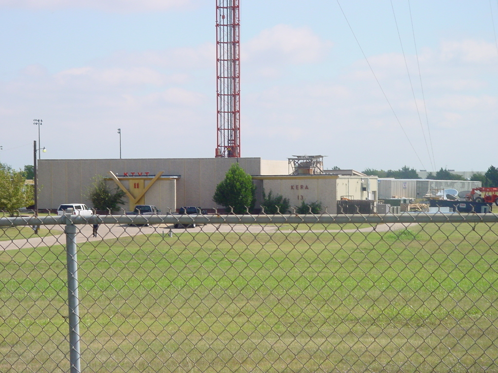
- Calculate coverage from the KERA radio antenna (We are actually using their main antenna in Cedar Hill, which they lease from channel 11.)
- Download data here
- Tower height: app. 1100 ft.
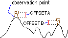
You include these variables in the analysis as attributes in the point feature class.
Things to note: (1) We will need to convert the Kera tower point to meters and (2) we will need to convert the height from feet to meters.
_____________________________
Automation of Shortest Path
- NOTE: I have never done this using the ModelBuilder. We will figure it out together. Homework will be to complete it as best you are able.
- Use this military path data.
- Work on your own files for the shortest path exercise. Things have been wild leading up to GIS Day last week, and an unfortunate accident happened to my son. This combined to push me out of work and email for some time and let's just take care of this right now.
- Discuss remaining schedule
- 3D Visualizations Exercise (DATA) - Fun Stuff! (data source)
- Export to Google Earth
- 3D Analyst Export to KML (KMZ)
- Template for method 2
** No Class Nov 15 **
Last Minute GIS Day Preparations driving me crazy.
Hopefully see many of you guys on Wednesday!
I think I have now received all group terrain edits and will redistribute by this afternoon.
Thanks guys!
3D Exercise
- Download Exercise
- Exporting to Google Earth using 3D Analyst and also KML manual editing (for higher resolution)
:: Shortest Path (least cost) analysis will be done in Spatial Analyst.
:: Each team will turn in a KML file, not ArcGIS files. We will discuss ArcGIS 3D Analyst and Google Earth next week.
:: Least Cost Procedure Background
- Run through Military Path demo
- Down data here
Download guide here(incorrect version, will post corrected version after class)- Each team will create a new (and unique) military terrain in the San Juan Mountains.
- Create, by hand:
- Mission Points
- Known/suspected mine fields
- Known/suspected enemy locations
- Edited highway layer
- Please make it possible for other teams to generate a path
- Take into consideration that the path cannot traverse over:
- Water Bodies
- Highways (delete segments to create a passable terrain)
- Teams will then trade these created terrain scenarios.
- Shortest path project will be based on:
- Traverse through the military terrain provided to each team, taking into consideration any of the datasets provided in the San Juan Mountain geodatabase (download from UTA server). The more datasets included in the generated path, the better. The best projects will make unique and creative uses of the various datasets available.
- Why San Juan Mountains and not here in Texas? Our topography is boring.
- Reminder about GIS Day
- Go over exam
- Add a custom toolbar in ArcMap and add a button referencing a geoprocessing tool
- Review Pizza Demo model as a reference
- Open session to work on projects
Create a Site Selection Suitability Model
- We will decide in class what to focus on
- This will give us the opportunity to discuss/review SimplyMap, ESRI TIGER, and ReferenceUSA
Download it!
Model I Made!
Reminder about GIS Day!
Items Discussed Today:
- Geoprocessing Tools in ArcToolbox
- Creating a Model
- Including Geoprocessing Tools in Model
- Adding Parameters
- Environmental Settings
- Convert this table into a shapefile.
- First convert to temporary event class
- Right-click/Display XY Data
- X: Long
- Y: Lat
- Spatial Reference: NAD 83
- Second export the event class to new shapefile
- Right-click/Data/Export Data
- Convert this table into a shapefile exclusively using the Geoprocessing Tools. (No right-clicking and no toolbars.)
- Create Temporary Layer: ArcToolbox/Data Management Tools/Layers and Table Views/Make XY Event Layer
- Copy to New Shapefile: ArcToolbox/Data Management Tools/Features/Copy Features
- Create an Automated Model that does the same thing as the above procedure.
- Create a new Toolbox in ArcCatalog (right-click/New Model)
- Add this Toolbox to ArcMap (right-click ArcToolbox/Add Model)
- Create a new Model in the Toolbox (right-click/New Model)
- Edit Model (Right-click Model/Edit)
!! CLASS ENDING 630PM !!
!! NO HOMEWORK DUE NEXT WEEK !!
Plan for Today's Class
1. Explore datasets for Coast Guard site selection project.
- Texas General Land Office: GIS (source) (backup)\
- GLO NRI Data
- A good background map (base map) is: Geography Network/Census 2000 ArcIMS layer
2. Class Exercize:
We are the xSkaters and need to find a cool place in Tarrant County to practice our downhill skateboarding.
Criteria (2 cut for abbreviated class):
- Steep slope as possible
Far from major roads- Low number of households
Prefer not to be within .5 KM of schools
- Elevation (prepared NED)
- Major Roads (Texas GLO)
- Number of households (prepared households)
- For those of you who may have concerns about how/where to access the demographic data for your projects, use this file!
- Schools (TEA)
To convert a file's coordinate system, use ArcToolbox/Data Management Tools/Projections & Transformations/

- Review homework & ensure everyone is member of team.
- Introduce the Spatial Analyst Toolbar
- Explore Surface Analysis functions
- Download 30-meter DEM for Arlington Quad from TNRIS. [DIRECT LINK]
- ArcGIS can not read DEM (digital elevation models). It must be extracted to a location on your computer with no spaces in the path. Then use ArcToolbox/Conversion Tools/To raster/DEM to Raster
- Create contour lines, slope, aspect, and hillshade.
- Class Exercise: Where in the D/FW Metroplex should we open a new pizzeria?
- Download materials here
- We will be following (kind of) the Guide_WithoutGeoprocessing.doc.
- Same dataset we used last class and homework.
Here's what I want for us to do:
Subscribe to:
Posts (Atom)